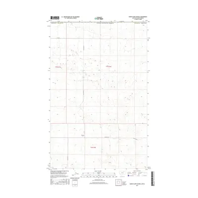
2017 Map of Sunny Slope School
USGS Topo · Published 2017About this map
Sunny Slope School stands as a focal point in this high plains landscape of north-central Montana, situated just south of the international boundary with Canada. The map illustrates a rural environment defined by a sparse network of section-line roads, including Sunnyslope Rd and N Sunnyslope Rd, which navigate the vast open terrain of Phillips County. The grid system of the Public Land Survey System is clearly visible, with t37n r28e and t36n r28e marking the legal divisions of the territory. This map captures the characteristic isolation of the northern prairie, where a single schoolhouse and a handful of gravel routes like Hutton Rd represent the essential infrastructure of a remote ranching and farming community.
Find a feature on this map
10 named features on this map. Tap any name to fly to it.
Don’t see what you’re looking for? This feature index may not catch every label — zoom into the map to look around manually.
Map Details
Editions of this 2017 Sunny Slope School Map
This is the sole edition of this map. No revisions or reprints were ever made.
Other maps of this area

1920 · Avery
USGS Topo · 1:125,000

1920 · Cowan
USGS Topo · 1:125,000

1953 · Havre
USGS Topo · 1:250,000

1954 · Glasgow
USGS Topo · 1:250,000

1957 · Glasgow
USGS Topo · 1:250,000

1957 · Havre
USGS Topo · 1:250,000

1958 · Glasgow
USGS Topo · 1:250,000

1958 · Havre
USGS Topo · 1:250,000

1984 · Chapman
USGS Topo · 1:24,000
1984 · Chapman NW
USGS Topo · 1:24,000