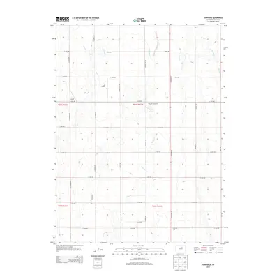
2013 Map of Sunnydale
USGS Topo · Published 2013About this map
Sunnydale Community House stands as a central landmark in this portion of rural Adams County, situated amidst a landscape defined by an extensive grid of section-line roads and irrigation infrastructure. The Henrylyn Canal and its various branches wind through the northern terrain, illustrating the critical role of water management in this agricultural region. This 2013 survey shows the intersection of aviation and farming, with private landing strips like JJS Airport and Flying E Airport punctuating the open fields. The drainage patterns of West Sand Creek and Lost Cr provide the primary natural relief against the predominantly flat topography, while north-south corridors like CO Highway 79 and Yulle Rd facilitate local transit across the vast reaches of the plains east of the metropolitan corridor.
Find a feature on this map
31 named features on this map. Tap any name to fly to it.
Don’t see what you’re looking for? This feature index may not catch every label — zoom into the map to look around manually.
Map Details
Editions of this 2013 Sunnydale Map
This is the sole edition of this map. No revisions or reprints were ever made.
Other maps of this area

1890 · East Denver
USGS Topo · 1:125,000

1902 · Greeley
USGS Topo · 1:125,000

1949 · Sunnydale
USGS Topo · 1:24,000

1949 · Bennett
USGS Topo · 1:24,000

1950 · South Roggen
USGS Topo · 1:24,000

1950 · Keenesburg
USGS Topo · 1:24,000

1950 · Prospect Valley
USGS Topo · 1:24,000

1950 · Roper School
USGS Topo · 1:24,000

1951 · Keenesburg
USGS Topo · 1:24,000

1951 · Prospect Valley
USGS Topo · 1:24,000