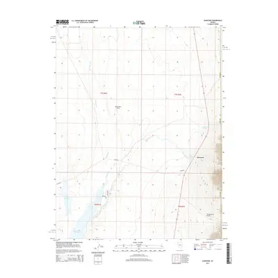
2014 Map of Sunnyside
USGS Topo · Published 2014About this map
White River Valley defines this portion of Nye County, where water and desert topography meet in a network of springs and reservoirs. The settlement of Sunnyside serves as a focal point along the state highway, situated near the confluence of the White River and Sunnyside Cr. The hydrology of the area is particularly noteworthy, featuring the large Adams-McGill Reservoir and Dacey Reservoir to the south, which are essential landmarks for understanding the managed water resources of the Great Basin. To the east, the terrain rises sharply into the mountains, marked by Trough Spring Canyon. Local passage through the landscape is facilitated by named routes such as Badger Pass and Wildlife Dr, while Butterfield Springs and Flag Springs provide discrete points of historical and ecological interest in an otherwise arid expanse.
Find a feature on this map
18 named features on this map. Tap any name to fly to it.
Don’t see what you’re looking for? This feature index may not catch every label — zoom into the map to look around manually.
Map Details
Editions of this 2014 Sunnyside Map
This is the sole edition of this map. No revisions or reprints were ever made.
Other maps of this area

1956 · Lund
USGS Topo · 1:250,000

1960 · Lund
USGS Topo · 1:250,000

1969 · Gap Mountain
USGS Topo · 1:24,000

1969 · Shingle Pass
USGS Topo · 1:24,000

1969 · Sunnyside
USGS Topo · 1:24,000

1969 · Moorman Spring SE
USGS Topo · 1:24,000

1969 · Hot Creek Butte
USGS Topo · 1:24,000

1969 · Sunnyside NW
USGS Topo · 1:24,000

1969 · Moorman Spring
USGS Topo · 1:24,000

1971 · Cave Valley Well
USGS Topo · 1:24,000