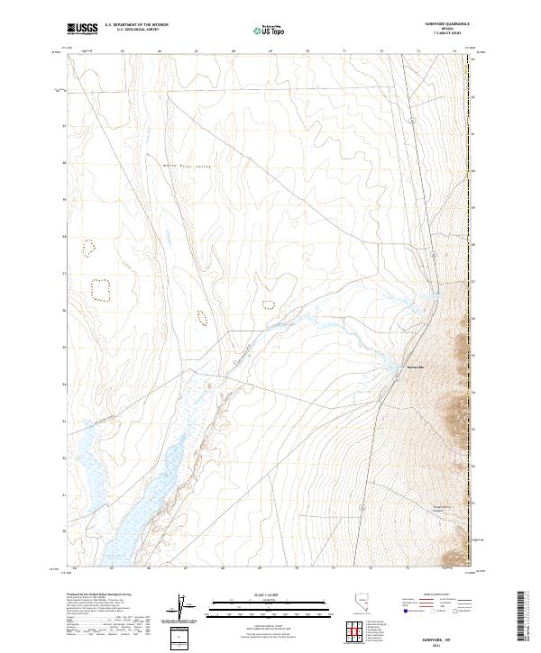
2021 Map of Sunnyside
USGS Topo · Published 2021About this map
Sunnyside serves as the focal point of this rural Nye County landscape, where the waters of the White River and Sunnyside Cr meet the arid expanse of the White River Valley. This 2021 survey documents an environment defined by its water resources, featuring a series of essential desert springs including Flag Spring and Butterfield Springs. The southern portion of the sheet is dominated by the Adams-McGill Reservoir, a significant catchment area that highlights the region's managed hydrography. The terrain rises sharply to the east at Trough Spring Canyon, while the valley floor is accessed by remote thoroughfares like Dave Deacon Camp Rd and Wildlife Dr. This map illustrates the vital relationship between limited water sources and the sparsely populated High Desert interior of Nevada.
Find a feature on this map
15 named features on this map. Tap any name to fly to it.
Don’t see what you’re looking for? This feature index may not catch every label — zoom into the map to look around manually.
Map Details
Editions of this 2021 Sunnyside Map
This is the sole edition of this map. No revisions or reprints were ever made.
Other maps of this area

1956 · Lund
USGS Topo · 1:250,000

1960 · Lund
USGS Topo · 1:250,000

1969 · Gap Mountain
USGS Topo · 1:24,000

1969 · Shingle Pass
USGS Topo · 1:24,000

1969 · Sunnyside
USGS Topo · 1:24,000

1969 · Moorman Spring SE
USGS Topo · 1:24,000

1969 · Hot Creek Butte
USGS Topo · 1:24,000

1969 · Sunnyside NW
USGS Topo · 1:24,000

1969 · Moorman Spring
USGS Topo · 1:24,000

1971 · Cave Valley Well
USGS Topo · 1:24,000