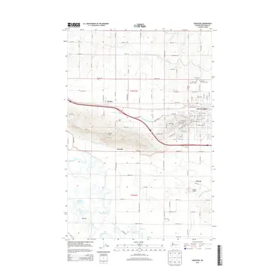
2013 Map of Sunnyside
USGS Topo · Published 2013About this map
Sunnyside and its surrounding Yakima County agricultural lands are defined by a complex irrigation network and the prominent rise of Snipes Mtn. This survey illustrates the intricate water management system essential to the region, featuring the Outlook Canal, Turner Lateral, and the Snipes Mountain Lateral that contour around the higher elevations of Harrison Hill. To the south, the Yakima River meanders through a riparian landscape marked by McBride Slough and Satus Bar. Genealogists and local historians can locate several significant burial grounds north of the city center, including Sunnyside Cem and Lower Valley Memorial Gardens. Smaller rural hubs like Outlook, Emerald, and Midvale anchor the grid of country roads, while landforms like Peanut Hump provide distinct local landmarks amidst the valley floor.
Find a feature on this map
110 named features on this map. Tap any name to fly to it.
Don’t see what you’re looking for? This feature index may not catch every label — zoom into the map to look around manually.
Map Details
Editions of this 2013 Sunnyside Map
This is the sole edition of this map. No revisions or reprints were ever made.
Other maps of this area

1910 · Zillah
USGS Topo · 1:125,000

1915 · Prosser
USGS Topo · 1:125,000

1917 · Prosser
USGS Topo · 1:125,000

1950 · Yakima
USGS Topo · 1:250,000

1950 · Grandview
USGS Topo · 1:62,500

1951 · Grandview
USGS Topo · 1:62,500

1953 · Walla Walla
USGS Topo · 1:250,000

1958 · Walla Walla
USGS Topo · 1:250,000

1958 · Yakima
USGS Topo · 1:250,000

1961 · Yakima
USGS Topo · 1:250,000