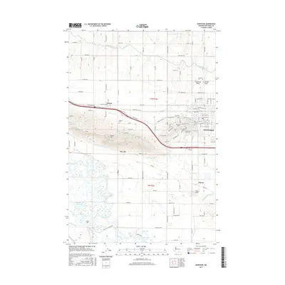
2017 Map of Sunnyside
USGS Topo · Published 2017About this map
The city of Sunnyside anchors this Yakima Valley landscape, showing a dense street grid that transitions into a highly engineered agricultural environment. An extensive network of irrigation infrastructure, including the Sunnyside Canal and Turner Lateral, winds around local elevations like Snipes Mtn and Harrison Hill. These water systems are central to the valley's development, enabling the orchards and fields that surround smaller settlements like Outlook, Emerald, and Midvale. Along the southern edge, the Yakima River meanders near the Dept of Fish and Wildlife lands and Game Reserve, creating a complex of wetlands including McBride Slough and Bounds Pond. For those tracing local history, the map identifies several significant burial sites, from the Outlook Cem to the concentrated group of Sunnyside Cem, Lower Valley Memorial Gardens, and Sunnyside Memorial Gardens north of the main city center.
Find a feature on this map
112 named features on this map. Tap any name to fly to it.
Don’t see what you’re looking for? This feature index may not catch every label — zoom into the map to look around manually.
Map Details
Editions of this 2017 Sunnyside Map
This is the sole edition of this map. No revisions or reprints were ever made.
Other maps of this area

1910 · Zillah
USGS Topo · 1:125,000

1915 · Prosser
USGS Topo · 1:125,000

1917 · Prosser
USGS Topo · 1:125,000

1950 · Yakima
USGS Topo · 1:250,000

1950 · Grandview
USGS Topo · 1:62,500

1951 · Grandview
USGS Topo · 1:62,500

1953 · Walla Walla
USGS Topo · 1:250,000

1958 · Walla Walla
USGS Topo · 1:250,000

1958 · Yakima
USGS Topo · 1:250,000

1961 · Yakima
USGS Topo · 1:250,000