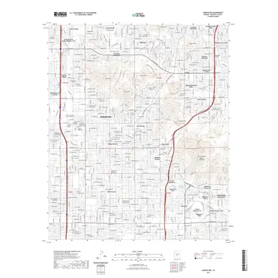
2021 Map of Sunnyslope
USGS Topo · Published 2021About this map
Sunnyslope sits at the heart of this urban landscape, where the dense residential grid of northern Phoenix meets the sharp rises of the Phoenix Mountains. The map highlights the complex relationship between the desert topography and modern development, with neighborhoods like Palmas Royale and Villa Novena tucked between prominent peaks such as Shaw Butte, North Mtn, and Piestewa Peak Phoenix Mountains. Significant educational and religious institutions are distributed throughout the area, including the SAGU American Indian College and the Church of the Beatitudes Columbarium. Water management remains a primary feature of the desert environment, evidenced by the large-scale engineering of the Arizona Canal and the Grand Canal visible in the southern reaches. An extensive network of recreational paths, such as the Trail 100 Trl and The Perl Charles Trl, weaves through the preserved mountain terrain, bridging the gap between urban centers like The Pointe and the open slopes of Moon Mtn.
Find a feature on this map
64 named features on this map. Tap any name to fly to it.
Don’t see what you’re looking for? This feature index may not catch every label — zoom into the map to look around manually.
Map Details
Editions of this 2021 Sunnyslope Map
This is the sole edition of this map. No revisions or reprints were ever made.
Other maps of this area

1904 · Camelback
USGS Topo · 1:62,500

1906 · Camelsback
USGS Topo · 1:62,500

1912 · Phoenix
USGS Topo · 1:62,500

1913 · Mesa
USGS Topo · 1:62,500

1914 · Phoenix
USGS Topo · 1:62,500

1915 · Mesa
USGS Topo · 1:62,500

1930 · Cave Creek
USGS Topo · 1:125,000

1939 · Cave Creek
USGS Topo · 1:125,000

1952 · Tempe
USGS Topo · 1:24,000

1952 · Phoenix
USGS Topo · 1:24,000