1971 Map of Sunnyslope
USGS Topo · Published 1972About this map
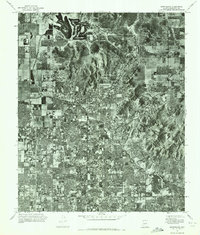
Sunnyslope appears as a developing suburban enclave during the early 1970s, shown here in an orthophotomosaic composed of aerial imagery. The landscape is defined by the contrast between the residential grid of Phoenix to the south and the sharp desert terrain of the Phoenix Mountains. The Arizona Canal cuts a distinct horizontal path across the valley floor, serving as a critical piece of water infrastructure for the growing desert metropolis. Prominent elevations including Shaw Butte, North Mountain, and Squaw Peak rise abruptly from the surrounding flatlands, their natural slopes remaining largely untouched even as housing developments begin to press against their bases. This aerial perspective provides a unique look at the rapid mid-century expansion of the Salt River Valley before the most intensive modern infill occurred.
Find a feature on this map
6 named features on this map. Tap any name to fly to it.
Don’t see what you’re looking for? This feature index may not catch every label — zoom into the map to look around manually.
Map Details
Editions of this 1971 Sunnyslope Map
This is the sole edition of this map. No revisions or reprints were ever made.
Other maps of this area

1904 · Camelback
USGS Topo · 1:62,500

1906 · Camelsback
USGS Topo · 1:62,500

1912 · Phoenix
USGS Topo · 1:62,500

1913 · Mesa
USGS Topo · 1:62,500

1914 · Phoenix
USGS Topo · 1:62,500

1915 · Mesa
USGS Topo · 1:62,500

1930 · Cave Creek
USGS Topo · 1:125,000

1939 · Cave Creek
USGS Topo · 1:125,000

1952 · Tempe
USGS Topo · 1:24,000

1952 · Phoenix
USGS Topo · 1:24,000