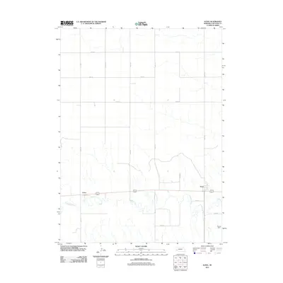
2011 Map of Sunol
USGS Topo · Published 2011About this map
Lodgepole Creek meanders across the southern portion of this landscape, carving a valley that has historically served as a vital transportation corridor through Cheyenne County. The settlements of Sunol and Colton are positioned along this waterway, aligned with the regional rail and road infrastructure that follows the creek’s path. The northern two-thirds of the area are defined by an orderly grid of section lines, including Road 34 and Road 125, which organize the agricultural upland.
Find a feature on this map
15 named features on this map. Tap any name to fly to it.
Don’t see what you’re looking for? This feature index may not catch every label — zoom into the map to look around manually.
Map Details
Editions of this 2011 Sunol Map
This is the sole edition of this map. No revisions or reprints were ever made.
Other maps of this area

1899 · Sidney
USGS Topo · 1:125,000

1954 · Scottsbluff
USGS Topo · 1:250,000

1958 · Scottsbluff
USGS Topo · 1:250,000

1972 · Gurley
USGS Topo · 1:24,000

1972 · Lodgepole
USGS Topo · 1:24,000

1972 · Lisco SW
USGS Topo · 1:24,000
1972 · Lodgepole SW
USGS Topo · 1:24,000

1972 · Sunol
USGS Topo · 1:24,000
1972 · Dalton SE
USGS Topo · 1:24,000
1972 · Sidney Muni. Airport
USGS Topo · 1:24,000