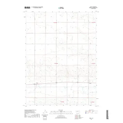
2017 Map of Sunol
USGS Topo · Published 2017About this map
Lodgepole Cr winds through the southern portion of this Cheyenne County landscape, anchoring the small settlements of Sunol and Colton. The terrain is characterized by the broad valley of the creek, which historically served as a vital corridor for both rail and road transport across the Nebraska plains. This 2017 survey shows the established section lines and a grid of rural routes like Rd 34 and Rd 125 that define the agricultural character of the region. The map highlights the intersection of modern infrastructure and the natural drainage patterns of the High Plains, with Link 17 E providing a primary connection to the community of Sunol.
Find a feature on this map
21 named features on this map. Tap any name to fly to it.
Don’t see what you’re looking for? This feature index may not catch every label — zoom into the map to look around manually.
Map Details
Editions of this 2017 Sunol Map
This is the sole edition of this map. No revisions or reprints were ever made.
Other maps of this area

1899 · Sidney
USGS Topo · 1:125,000

1954 · Scottsbluff
USGS Topo · 1:250,000

1958 · Scottsbluff
USGS Topo · 1:250,000

1972 · Gurley
USGS Topo · 1:24,000

1972 · Lodgepole
USGS Topo · 1:24,000

1972 · Lisco SW
USGS Topo · 1:24,000
1972 · Lodgepole SW
USGS Topo · 1:24,000

1972 · Sunol
USGS Topo · 1:24,000
1972 · Dalton SE
USGS Topo · 1:24,000
1972 · Sidney Muni. Airport
USGS Topo · 1:24,000