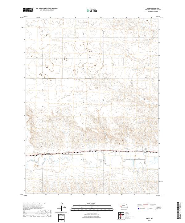
2021 Map of Sunol
USGS Topo · Published 2021About this map
Sunol and Colton anchor this corner of the High Plains, situated along the east-west corridor that historically followed the valley of Lodgepole Cr. The map illustrates a landscape defined by the Public Land Survey System, with township lines such as t14n r48w and t15n r47w marking the expansive agricultural and grazing lands of Cheyenne County. While the terrain is etched with intermittent drainages and coulees, human activity is concentrated along the established grid of section roads like RD 131 and RD 30. The presence of Link 17 E near Sunol highlights the area's continued reliance on a structured transportation network that mirrors the path of earlier pioneers and rail travelers moving across Nebraska.
Find a feature on this map
21 named features on this map. Tap any name to fly to it.
Don’t see what you’re looking for? This feature index may not catch every label — zoom into the map to look around manually.
Map Details
Editions of this 2021 Sunol Map
This is the sole edition of this map. No revisions or reprints were ever made.
Other maps of this area

1899 · Sidney
USGS Topo · 1:125,000

1954 · Scottsbluff
USGS Topo · 1:250,000

1958 · Scottsbluff
USGS Topo · 1:250,000

1972 · Gurley
USGS Topo · 1:24,000

1972 · Lodgepole
USGS Topo · 1:24,000

1972 · Lisco SW
USGS Topo · 1:24,000
1972 · Lodgepole SW
USGS Topo · 1:24,000

1972 · Sunol
USGS Topo · 1:24,000
1972 · Dalton SE
USGS Topo · 1:24,000
1972 · Sidney Muni. Airport
USGS Topo · 1:24,000