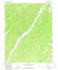
1961 Map of Sunrise
USGS Topo · Published 1981About this map
Sunrise and the surrounding drainage of Back Creek dominate this 1961 field-checked survey of the Virginia and West Virginia borderlands. The landscape is defined by the sharp divide between the George Washington National Forest and the Monongahela National Forest, with the state line cutting through the high ridges of Little Mountain. For the local historian, the map preserves the locations of rural infrastructure such as Zion Hill Ch and several family burying grounds, including Lightner Cem, Doyle Cem, and Sively Cem. The settlement pattern follows the narrow valley floors of the Jackson River and its numerous tributaries like Little Back Creek. Small mountain clearings and sites like Fodder House and Chestnut Levels suggest the persistence of small-scale upland agriculture and timbering in this remote section of Bath and Pocahontas counties.
Find a feature on this map
53 named features on this map. Tap any name to fly to it.
Don’t see what you’re looking for? This feature index may not catch every label — zoom into the map to look around manually.
Map Details
Editions of this 1961 Sunrise Map
2 editions found
Other maps of this area

1901 · Monterey
USGS Topo · 1:125,000

1922 · Cass
USGS Topo · 1:48,000

1923 · Warm Springs
USGS Topo · 1:48,000

1924 · Cass
USGS Topo · 1:62,500

1926 · Warm Springs
USGS Topo · 1:62,500

1930 · Warm Springs Run
USGS Topo · 1:24,000

1930 · Mountain Grove
USGS Topo · 1:24,000

1933 · Mountain Grove
USGS Topo · 1:31,680

1933 · Warm Springs Run
USGS Topo · 1:31,680

1941 · Monterey
USGS Topo · 1:62,500