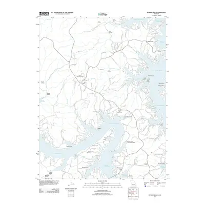
2011 Map of Sunrise Beach
USGS Topo · Published 2011About this map
Sunrise Beach and Laurie anchor this detailed 2011 survey of the winding shoreline along the Lake of the Ozarks. The map illustrates a landscape defined by deep coves and jagged peninsulas, where residential developments like Danner Estates Dr and Timber Meadows Pt meet established local landmarks. Notable aviation infrastructure is visible at the Mistwood Airport and Adkins Landing Strip, while the Hurricane Deck Lookout Tower stands as a prominent point over the Hurricane Deck area. Genealogists can locate several local burial grounds, including the Garber Memorial Cemetery, Cape Galena Cemetery, and Silvey Cemetery. The intricate waterway network, featuring Buck Creek Cove and Easter Hollow Cove, highlights the mid-century transition of this Camden County region into a major recreational hub, though older sites like Porter Mill Bend and Porter Mill Hollow hint at the area's earlier agrarian and milling foundations.
Find a feature on this map
156 named features on this map. Tap any name to fly to it.
Don’t see what you’re looking for? This feature index may not catch every label — zoom into the map to look around manually.
Map Details
Editions of this 2011 Sunrise Beach Map
This is the sole edition of this map. No revisions or reprints were ever made.
Other maps of this area

1888 · Versailles
USGS Topo · 1:125,000

1893 · Versailles
USGS Topo · 1:125,000

1904 · Eldon
USGS Topo · 1:62,500

1904 · Gravois Mills
USGS Topo · 1:62,500

1932 · Versailles No 4
USGS Topo · 1:48,000

1934 · Camdenton
USGS Topo · 1:24,000

1934 · Purvis
USGS Topo · 1:24,000

1934 · Irontown Ferry
USGS Topo · 1:24,000

1934 · Lake Ozark
USGS Topo · 1:24,000

1934 · Green Bay Terrace
USGS Topo · 1:24,000