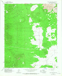
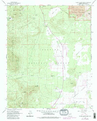
1966 Map of Sunset Crater West
USGS Topo · Published 1968About this map
Volcanic topography dominates this mid-1960s survey of the high desert and mountain slopes, anchored by the Sunset Crater National Monument in the northeast. The landscape transitions from the jagged peaks of the San Francisco Mountains and Elden Mountain down into the expansive open flats of Cinder Lake. This era shows a rugged terrain utilized for its natural resources, evidenced by several specialized excavations including a Pumice Pit and a Gravel Pit near Sugarloaf.
Find a feature on this map
32 named features on this map. Tap any name to fly to it.
Don’t see what you’re looking for? This feature index may not catch every label — zoom into the map to look around manually.
Map Details
Editions of this 1966 Sunset Crater West Map
5 editions found
Other maps of this area

1886 · San Francisco Mtns
USGS Topo · 1:250,000

1891 · San Francisco Mtns
USGS Topo · 1:250,000

1894 · San Francisco Mtns
USGS Topo · 1:250,000

1899 · San Francisco Mtns
USGS Topo · 1:250,000

1908 · Flagstaff
USGS Topo · 1:125,000

1912 · Flagstaff
USGS Topo · 1:125,000

1947 · Flagstaff
USGS Topo · 1:250,000

1954 · Flagstaff
USGS Topo · 1:250,000

1958 · Flagstaff
USGS Topo · 1:250,000

1960 · Flagstaff
USGS Topo · 1:250,000