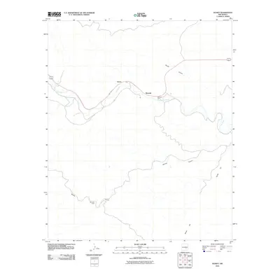
2010 Map of Sunset
USGS Topo · Published 2010About this map
Rio Hondo flows through this section of Lincoln County, carving a valley that has long dictated the movement of people and commerce. The settlements of Sunset and Riverside are positioned along the water's path, where the narrow corridor provides a rare strip of level ground for habitation. This 2010 survey illustrates how the local road network, including the route marked 70 380, follows the natural contours of the land, navigating around the deep incisions of Border Canyon and Bonney Canyon. The presence of the McKnight Ranch highlights the traditional ranching heritage of the area, while the prominence of Border Hill to the southeast serves as a significant navigational marker in this part of the New Mexico landscape.
Find a feature on this map
8 named features on this map. Tap any name to fly to it.
Don’t see what you’re looking for? This feature index may not catch every label — zoom into the map to look around manually.
Map Details
Editions of this 2010 Sunset Map
This is the sole edition of this map. No revisions or reprints were ever made.
Other maps of this area

1955 · Roswell
USGS Topo · 1:250,000

1958 · Roswell
USGS Topo · 1:250,000

1961 · Flying H
USGS Topo · 1:62,500

1961 · Indian Bluff
USGS Topo · 1:62,500

1961 · Tinnie
USGS Topo · 1:62,500

1962 · Roswell
USGS Topo · 1:250,000

1962 · Horseshoe Bend
USGS Topo · 1:62,500

1979 · Roswell
USGS Topo · 1:100,000

1984 · Ruidoso
USGS Topo · 1:100,000
1988 · Nelson Canyon East
USGS Topo · 1:24,000