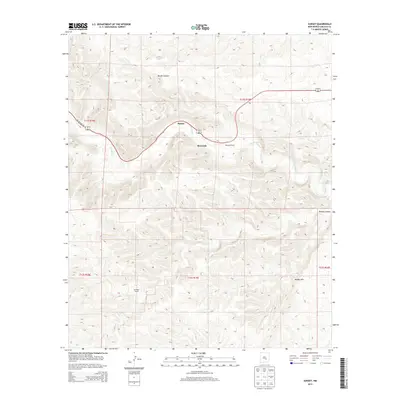
2013 Map of Sunset
USGS Topo · Published 2013About this map
The Rio Hondo cuts through this high desert terrain in Lincoln County, creating a fertile valley corridor that supports the small settlements of Sunset and Riverside. This 2013 survey captures the landscape as it follows the winding path of US Highway 70, which serves as the primary artery connecting these rural communities. The map highlights the localized ranching culture of the region, specifically marking the McKnight Ranch as a significant landmark in the area.
Find a feature on this map
13 named features on this map. Tap any name to fly to it.
Don’t see what you’re looking for? This feature index may not catch every label — zoom into the map to look around manually.
Map Details
Editions of this 2013 Sunset Map
This is the sole edition of this map. No revisions or reprints were ever made.
Other maps of this area

1955 · Roswell
USGS Topo · 1:250,000

1958 · Roswell
USGS Topo · 1:250,000

1961 · Flying H
USGS Topo · 1:62,500

1961 · Indian Bluff
USGS Topo · 1:62,500

1961 · Tinnie
USGS Topo · 1:62,500

1962 · Roswell
USGS Topo · 1:250,000

1962 · Horseshoe Bend
USGS Topo · 1:62,500

1979 · Roswell
USGS Topo · 1:100,000

1984 · Ruidoso
USGS Topo · 1:100,000
1988 · Nelson Canyon East
USGS Topo · 1:24,000