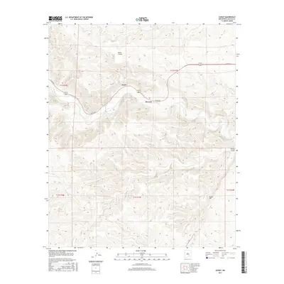
2017 Map of Sunset
USGS Topo · Published 2017About this map
Rio Hondo cuts through this high-desert landscape in Lincoln County, creating a narrow valley corridor where the settlements of Sunset and Riverside are located. This 2017 topographic survey shows the importance of the river drainage for transportation and habitation, as Co RD e022 closely follows its winding course between the steep walls of Border Canyon and Bonney Canyon. To the south, the terrain rises significantly toward the prominent Border Hill. The map meticulously details the section lines and township boundaries of the Public Land Survey System, illustrating how land ownership and ranching interests have been organized across this arid region of New Mexico.
Find a feature on this map
12 named features on this map. Tap any name to fly to it.
Don’t see what you’re looking for? This feature index may not catch every label — zoom into the map to look around manually.
Map Details
Editions of this 2017 Sunset Map
This is the sole edition of this map. No revisions or reprints were ever made.
Other maps of this area

1955 · Roswell
USGS Topo · 1:250,000

1958 · Roswell
USGS Topo · 1:250,000

1961 · Flying H
USGS Topo · 1:62,500

1961 · Indian Bluff
USGS Topo · 1:62,500

1961 · Tinnie
USGS Topo · 1:62,500

1962 · Roswell
USGS Topo · 1:250,000

1962 · Horseshoe Bend
USGS Topo · 1:62,500

1979 · Roswell
USGS Topo · 1:100,000

1984 · Ruidoso
USGS Topo · 1:100,000
1988 · Nelson Canyon East
USGS Topo · 1:24,000