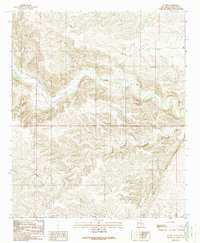
1988 Map of Sunset
USGS Topo · Published 1989About this map
Rio Hondo winds through the center of this Lincoln County landscape, serving as the primary corridor for settlement and transportation in the late 1980s. The small communities of Sunset and Riverside are positioned along the river's path, where the valley floor provides a break from the surrounding complex of ridges and drainages. The area is defined by significant topographical features such as Border Canyon to the north and the expansive Bonney Canyon to the south. This topographic study reflects a late-century update based on 1980s field checks, documenting a rural environment where infrastructure is concentrated along the river valley. The presence of a Roadside Park and various benchmark locations like BM 5135 along the highway route show the importance of the passage through this part of New Mexico, linking the isolated settlements to the wider region.
Find a feature on this map
16 named features on this map. Tap any name to fly to it.
Don’t see what you’re looking for? This feature index may not catch every label — zoom into the map to look around manually.
Map Details
Editions of this 1988 Sunset Map
This is the sole edition of this map. No revisions or reprints were ever made.
Other maps of this area

1955 · Roswell
USGS Topo · 1:250,000

1958 · Roswell
USGS Topo · 1:250,000

1961 · Flying H
USGS Topo · 1:62,500

1961 · Indian Bluff
USGS Topo · 1:62,500

1961 · Tinnie
USGS Topo · 1:62,500

1962 · Roswell
USGS Topo · 1:250,000

1962 · Horseshoe Bend
USGS Topo · 1:62,500

1979 · Roswell
USGS Topo · 1:100,000

1984 · Ruidoso
USGS Topo · 1:100,000
1988 · Nelson Canyon East
USGS Topo · 1:24,000