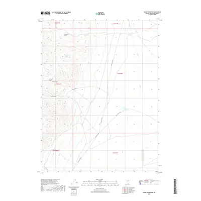
2018 Map of Sunset Reservoir
USGS Topo · Published 2018About this map
Antelope Range foothills dominate the western landscape of this White Pine County quadrangle, where high-altitude drainages like Cottonwood Canyon and Secret Canyon descend toward the valley floor. The desert terrain is marked by essential water sources, including Cottonwood Spring and the southern Tippett Springs, which historically supported livestock and travel through this arid region.
Find a feature on this map
19 named features on this map. Tap any name to fly to it.
Don’t see what you’re looking for? This feature index may not catch every label — zoom into the map to look around manually.
Map Details
Editions of this 2018 Sunset Reservoir Map
This is the sole edition of this map. No revisions or reprints were ever made.
Other maps of this area

1955 · Elko
USGS Topo · 1:250,000

1956 · Ely
USGS Topo · 1:250,000

1958 · Elko
USGS Topo · 1:250,000

1959 · Ely
USGS Topo · 1:250,000

1962 · Elko
USGS Topo · 1:250,000

1963 · Ely
USGS Topo · 1:250,000

1965 · Elko
USGS Topo · 1:250,000

1979 · Sunset Reservoir
USGS Topo · 1:24,000
1981 · Tippett Canyon
USGS Topo · 1:24,000
1981 · Spring Creek Flat NW
USGS Topo · 1:24,000