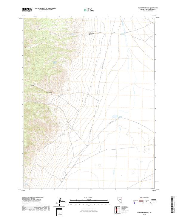
2021 Map of Sunset Reservoir
USGS Topo · Published 2021About this map
Antelope Range dominates the western topography of this White Pine County landscape, where deep incisions like Secret Canyon and Tunnel Canyon cut through the high desert terrain. The area is defined by its scarce but vital water sources, including Cottonwood Spring and the isolated Tippett Springs at the southern edge. The presence of Robison Reservoir and Sunset Reservoir indicates the critical role of water management in this arid region, supporting what little settlement exists, such as the curiously named Sellas One Hundred Fifty Two. This 2021 survey shows a landscape largely shaped by its natural drainages and limited transit corridors like Tunnel Canyon Rd, reflecting the enduring character of eastern Nevada's basin and range province.
Find a feature on this map
16 named features on this map. Tap any name to fly to it.
Don’t see what you’re looking for? This feature index may not catch every label — zoom into the map to look around manually.
Map Details
Editions of this 2021 Sunset Reservoir Map
This is the sole edition of this map. No revisions or reprints were ever made.
Other maps of this area

1955 · Elko
USGS Topo · 1:250,000

1956 · Ely
USGS Topo · 1:250,000

1958 · Elko
USGS Topo · 1:250,000

1959 · Ely
USGS Topo · 1:250,000

1962 · Elko
USGS Topo · 1:250,000

1963 · Ely
USGS Topo · 1:250,000

1965 · Elko
USGS Topo · 1:250,000

1979 · Sunset Reservoir
USGS Topo · 1:24,000
1981 · Tippett Canyon
USGS Topo · 1:24,000
1981 · Spring Creek Flat NW
USGS Topo · 1:24,000