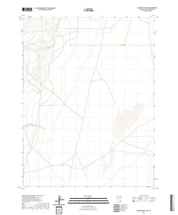
2021 Map of Sunshine Well NW
USGS Topo · Published 2021About this map
Long Valley dominates this high-desert landscape in White Pine County, where the topography of the Basin and Range province is clearly defined by the North American Vertical Datum of 1988. This 2021 map, produced using National Elevation Dataset and NAIP imagery, details a remote section of the Great Basin characterized by its distinct Public Land Survey System divisions. The grid of t22n r58e, t21n r58e, and t20n r58e illustrates the systematic organization of these federal lands, revealing the sparse network of local connectors and four-wheel-drive roads that navigate the valley floor between rising terrain. The lack of permanent water bodies or settlements on this sheet reflects the arid, unsettled character of this portion of eastern Nevada.
Find a feature on this map
10 named features on this map. Tap any name to fly to it.
Don’t see what you’re looking for? This feature index may not catch every label — zoom into the map to look around manually.
Map Details
Editions of this 2021 Sunshine Well NW Map
This is the sole edition of this map. No revisions or reprints were ever made.
Other maps of this area

1956 · Ely
USGS Topo · 1:250,000

1957 · Buck Mountain
USGS Topo · 1:62,500

1957 · Cold Creek Ranch
USGS Topo · 1:62,500

1959 · Ely
USGS Topo · 1:250,000

1963 · Ely
USGS Topo · 1:250,000
1982 · Cabin Spring
USGS Topo · 1:24,000
1982 · McBrides Sheep Well
USGS Topo · 1:24,000
1982 · Long Valley Slough
USGS Topo · 1:24,000

1982 · Dickenson Well
USGS Topo · 1:24,000

1982 · Sunshine Well
USGS Topo · 1:24,000