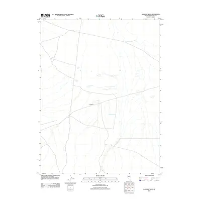
2012 Map of Sunshine Well
USGS Topo · Published 2012About this map
Long Valley stretches across this portion of eastern Nevada, defining a landscape shaped by intermittent water sources and high-desert terrain. In this remote corner of White Pine County, survival and land use are marked by the presence of vital water points like Moore Well in the north and the uniquely named Maple Syrup Well to the south. These isolated landmarks serve as the primary navigational and logistical anchors for a region characterized by vast open spaces and minimal infrastructure. The presence of Sunshine Well and J and J Well suggests the historical importance of groundwater access for ranching or local transit in an otherwise arid environment. This 2012 survey by the U.S. Geological Survey provides a precise record of these scattered water features and the network of local roads that connect them.
Find a feature on this map
5 named features on this map. Tap any name to fly to it.
Don’t see what you’re looking for? This feature index may not catch every label — zoom into the map to look around manually.
Map Details
Editions of this 2012 Sunshine Well Map
This is the sole edition of this map. No revisions or reprints were ever made.
Other maps of this area

1951 · Illipah
USGS Topo · 1:62,500

1951 · Pancake Summit
USGS Topo · 1:62,500

1956 · Ely
USGS Topo · 1:250,000

1957 · Buck Mountain
USGS Topo · 1:62,500

1959 · Ely
USGS Topo · 1:250,000

1963 · Ely
USGS Topo · 1:250,000

1979 · Mt. Hamilton
USGS Topo · 1:100,000
1982 · McBrides Sheep Well
USGS Topo · 1:24,000

1982 · Dickenson Well
USGS Topo · 1:24,000

1982 · Sunshine Well
USGS Topo · 1:24,000