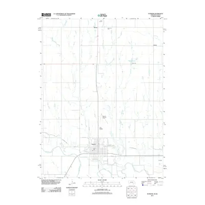
2011 Map of Superior
USGS Topo · Published 2011About this map
Superior serves as the focal point of this 2011 survey, situated along the northern banks of the Republican River. The landscape is defined by its water management infrastructure, most notably the Superior Canal which winds across the plains alongside several tributaries including Lost Creek, Blakely Creek, and Oak Creek. This modern record of the Nuckolls County border region illustrates a highly organized agricultural grid, punctuated by small rural settlements like Smyrna and Cadams. Local family history and geography are preserved through the identification of the Ladies Evergreen Cemetery north of the city and the Salem Cemetery near the northern boundary. Several water control structures, such as Grummert Dam, Higer Dam, and Saul Dam forming Higer Reservoir, indicate the critical role of irrigation and drainage in this prairie environment. The presence of the Superior Municipal Airport and the centrally located Superior Post Office highlights the town’s continued role as a regional hub for the surrounding countryside.
Find a feature on this map
29 named features on this map. Tap any name to fly to it.
Don’t see what you’re looking for? This feature index may not catch every label — zoom into the map to look around manually.
Map Details
Editions of this 2011 Superior Map
This is the sole edition of this map. No revisions or reprints were ever made.
Other maps of this area

1892 · Concordia
USGS Topo · 1:125,000

1894 · Mankato
USGS Topo · 1:125,000

1898 · Superior
USGS Topo · 1:125,000

1898 · Hebron
USGS Topo · 1:125,000

1955 · Manhattan
USGS Topo · 1:250,000

1955 · Lincoln
USGS Topo · 1:250,000

1955 · Grand Island
USGS Topo · 1:250,000

1955 · Beloit
USGS Topo · 1:250,000

1956 · Manhattan
USGS Topo · 1:250,000

1957 · Manhattan
USGS Topo · 1:250,000