
1915 Map of Superior
USGS Topo · Published 1915About this map
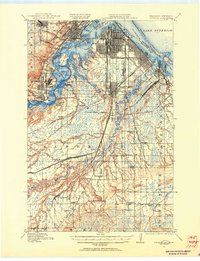
St Louis Bay and the industrial waterfront of Superior define this mid-1910s landscape, where a dense network of competing railroads converges on the Great Lakes. The map illustrates a period of significant industrial growth, with specialized company towns and neighborhoods like Morgan Park, Steelton, and Gary appearing alongside the St Louis River. The shoreline is heavily shaped by commerce, featuring the long reach of Minnesota Point and the protected waters of Allouez Bay.
Find a feature on this map
55 named features on this map. Tap any name to fly to it.
Don’t see what you’re looking for? This feature index may not catch every label — zoom into the map to look around manually.
Map Details
Editions of this 1915 Superior Map
2 editions found
Other maps of this area

1895 · Duluth
USGS Topo · 1:62,500

1917 · Superior
USGS Topo · 1:62,500

1945 · Solon Springs
USGS Topo · 1:48,000

1949 · Solon Springs
USGS Topo · 1:48,000

1949 · Holyoke
USGS Topo · 1:48,000

1949 · Patzau
USGS Topo · 1:48,000

1949 · Poplar
USGS Topo · 1:48,000

1953 · Lakewood
USGS Topo · 1:24,000

1953 · Adolph
USGS Topo · 1:24,000

1953 · Duluth
USGS Topo · 1:24,000