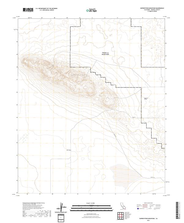
2021 Map of Superstition Mountain
USGS Topo · Published 2021About this map
Superstition Mtn rises as a prominent topographical feature above the surrounding lowlands of the Imperial Valley and the West Mesa. This 2021 survey of Imperial County detail's the mountain's complex contour patterns, revealing a landscape defined by significant elevation changes in an otherwise flat desert basin. The map illustrates the sparsely developed nature of this region, where human activity is primarily indicated by a few key transit corridors such as Imler Rd and Wheeler Rd. These roads skirt the base of the mountain and cross the mesa, likely serving local agricultural or utility access. The grid-based township and range boundaries, including t14s r11e, provide a clear framework for understanding land division and ownership patterns across this arid California terrain.
Find a feature on this map
11 named features on this map. Tap any name to fly to it.
Don’t see what you’re looking for? This feature index may not catch every label — zoom into the map to look around manually.
Map Details
Editions of this 2021 Superstition Mountain Map
This is the sole edition of this map. No revisions or reprints were ever made.
Other maps of this area

1915 · El Centro
USGS Topo · 1:125,000

1940 · Brawley
USGS Topo · 1:62,500

1940 · Kane Spring
USGS Topo · 1:62,500

1940 · Plaster City
USGS Topo · 1:62,500

1942 · El Centro
USGS Topo · 1:250,000

1943 · Brawley
USGS Topo · 1:62,500

1944 · Plaster City
USGS Topo · 1:62,500

1944 · Kane Spring
USGS Topo · 1:62,500

1944 · Calipatria
USGS Topo · 1:62,500

1954 · El Centro
USGS Topo · 1:250,000