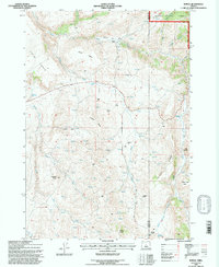
1992 Map of Suplee
USGS Topo · Published 1997About this map
Suplee (Site) marks a central point in this high-plateau landscape where the Crook and Grant county line divides the terrain. The map documents a sparsely populated ranching region characterized by expansive landforms like Soda Table and Shaw Table, interspersed with essential water sources such as Soda Spring and Henshaw Spring. The settlement pattern is defined by isolated holdings like Bernard Ranch and Weberg Ranch, suggesting a legacy of large-scale livestock operations typical of Central Oregon.
Find a feature on this map
44 named features on this map. Tap any name to fly to it.
Don’t see what you’re looking for? This feature index may not catch every label — zoom into the map to look around manually.
Map Details
Editions of this 1992 Suplee Map
This is the sole edition of this map. No revisions or reprints were ever made.
Other maps of this area

1932 · Dayville
USGS Topo · 1:125,000

1936 · Dayville
USGS Topo · 1:125,000

1955 · Burns
USGS Topo · 1:250,000

1955 · Canyon City
USGS Topo · 1:250,000

1958 · Burns
USGS Topo · 1:250,000

1959 · Burns
USGS Topo · 1:250,000

1959 · Canyon City
USGS Topo · 1:250,000

1961 · Delintment Lake
USGS Topo · 1:62,500
1981 · Powell Mtn
USGS Topo · 1:24,000

1981 · Suplee
USGS Topo · 1:24,000