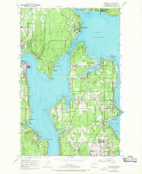
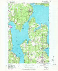
1953 Map of Suquamish
USGS Topo · Published 1969About this map
The Port Madison Indian Reservation and the northern reaches of Bainbridge Island define this coastal landscape, separated by the narrow currents of Agate Passage. Centered on the community of Suquamish, this survey documents the mid-century shoreline before significant modern development, including the local post office at Indianola. To the south, the map details the residential and civic growth of Bainbridge Island, from the waterfront at Winslow and Manitou Beach to the interior community at Island Center.
Find a feature on this map
61 named features on this map. Tap any name to fly to it.
Don’t see what you’re looking for? This feature index may not catch every label — zoom into the map to look around manually.
Map Details
Editions of this 1953 Suquamish Map
5 editions found
Other maps of this area

1894 · Seattle
USGS Topo · 1:62,500

1895 · Snohomish
USGS Topo · 1:125,000

1897 · Seattle
USGS Topo · 1:125,000

1908 · Seattle
USGS Topo · 1:62,500

1909 · Seattle Special
USGS Topo · 1:62,500

1937 · Port Orchard
USGS Topo · 1:62,500

1937 · Port Gamble
USGS Topo · 1:62,500

1940 · Port Gamble
USGS Topo · 1:62,500

1942 · Edmonds
USGS Topo · 1:62,500

1949 · Shilshole Bay
USGS Topo · 1:24,000