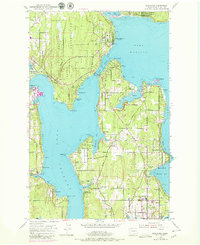
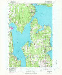
1953 Map of Suquamish
USGS Topo · Published 1979About this map
The Madison Indian Reservation and the northern reaches of Bainbridge Island dominate this mid-century survey of the Puget Sound's western shores. Centered on Suquamish, the landscape is defined by the complex waterways of Agate Passage, Liberty Bay, and Port Orchard. The map illustrates a transitional period for the Kitsap Peninsula, showing the Agate Pass Bridge connecting the mainland to the island's growing communities like Port Madison and Winslow. Extensive Naval Reservation lands at Keyport and Battle Point highlight the era's significant military footprint alongside established local institutions such as the Bainbridge Grange and Commodore Bainbridge Sch. Coastal settlements such as Indianola, Seabold, and Rollingbay are depicted with their original street grids, while the interior is marked by numerous Gravel Pits and timbered terrain typical of the region's resource-based economy before suburban expansion intensified.
Find a feature on this map
66 named features on this map. Tap any name to fly to it.
Don’t see what you’re looking for? This feature index may not catch every label — zoom into the map to look around manually.
Map Details
Editions of this 1953 Suquamish Map
5 editions found
Other maps of this area

1894 · Seattle
USGS Topo · 1:62,500

1895 · Snohomish
USGS Topo · 1:125,000

1897 · Seattle
USGS Topo · 1:125,000

1908 · Seattle
USGS Topo · 1:62,500

1909 · Seattle Special
USGS Topo · 1:62,500

1937 · Port Orchard
USGS Topo · 1:62,500

1937 · Port Gamble
USGS Topo · 1:62,500

1940 · Port Gamble
USGS Topo · 1:62,500

1942 · Edmonds
USGS Topo · 1:62,500

1949 · Shilshole Bay
USGS Topo · 1:24,000