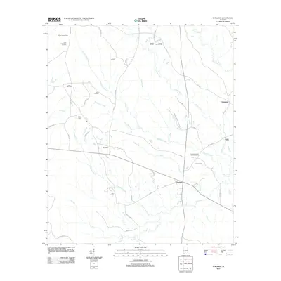
2011 Map of Surginer
USGS Topo · Published 2011About this map
Surginer and Vineland sit at the center of this rural Marengo County landscape, where the terrain is defined by a complex network of creeks and numerous historic burial grounds. The namesake village is surrounded by family-named landmarks and watercourses such as Pritchett Mill Creek and Threadgill Mill Creek, suggesting a legacy of early water-powered industry. Further east, Moores Valley and the settlement of Hampden anchor the drainage basin of Turkey Creek. Genealogists will find significant value in the high density of small, distinct cemeteries including Union Cemetery, Arbor Cemetery, and the Friendship Baptist Church Cemetery. The presence of the Shiloah Lookout Tower and the Magnolia Terminal further north reflects the region's intersection of timber management and modern transit infrastructure.
Find a feature on this map
60 named features on this map. Tap any name to fly to it.
Don’t see what you’re looking for? This feature index may not catch every label — zoom into the map to look around manually.
Map Details
Editions of this 2011 Surginer Map
This is the sole edition of this map. No revisions or reprints were ever made.
Other maps of this area

1953 · Montgomery
USGS Topo · 1:250,000

1953 · Andalusia
USGS Topo · 1:250,000

1956 · Montgomery
USGS Topo · 1:250,000

1957 · Montgomery
USGS Topo · 1:250,000

1957 · Andalusia
USGS Topo · 1:250,000

1973 · Pine Hill
USGS Topo · 1:24,000

1973 · Thomasville
USGS Topo · 1:24,000

1978 · Surginer
USGS Topo · 1:24,000

1978 · Sweet Water
USGS Topo · 1:24,000
1978 · Bashi
USGS Topo · 1:24,000