
1978 Map of Sweet Water
USGS Topo · Published 1979About this map
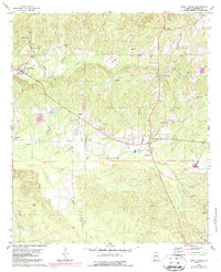
Sweet Water serves as the primary hub of this Marengo County landscape, characterized by a dense network of family-named churches and cemeteries that anchor the rural community. During the late 1970s, the area maintained its traditional settlement patterns, with concentrations of activity around Dixons Mills and Marengo. The topography is defined by the winding course of Sweetwater Creek and its many tributaries, including Quinney Mill Creek and Little Mud Creek. The map reveals a high density of spiritual and educational landmarks, such as Wayne Memorial Ch, Jones Chapel, and the Dixons Mills Sch, reflecting the importance of local institutions in this part of Alabama. Genealogists will find particular value in the scattered burial grounds like Morrissette Cem, Dunning Cem, and Pruitt Cem, which are tucked away near timberlands and small water bodies like Lewis Pond.
Find a feature on this map
38 named features on this map. Tap any name to fly to it.
Don’t see what you’re looking for? This feature index may not catch every label — zoom into the map to look around manually.
Map Details
Editions of this 1978 Sweet Water Map
2 editions found
Other maps of this area

1953 · Montgomery
USGS Topo · 1:250,000

1953 · Andalusia
USGS Topo · 1:250,000

1956 · Montgomery
USGS Topo · 1:250,000

1957 · Montgomery
USGS Topo · 1:250,000

1957 · Andalusia
USGS Topo · 1:250,000

1973 · Thomasville
USGS Topo · 1:24,000

1978 · Surginer
USGS Topo · 1:24,000
1978 · Bashi
USGS Topo · 1:24,000
1978 · Nanafalia
USGS Topo · 1:24,000
1978 · Myrtlewood South
USGS Topo · 1:24,000