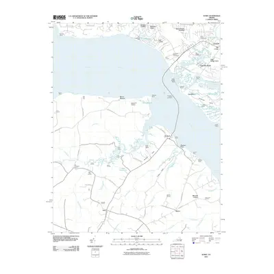
2010 Map of Surry
USGS Topo · Published 2010About this map
Jamestown and its surrounding historic Tidewater landscape are documented here as they appeared in 2010. The geography is defined by the broad expanse of the James River, which separates the colonial heart of Jamestown Island from the rural reaches of Surry County. This era reflects the enduring connection between the two shores, maintained by the Jamestown-Scotland Wharf Ferry. On the southern bank, the settlement patterns around Surry and Scotland are marked by significant local landmarks such as Smith Fort and the Swanns Point Plantation Cemetery. The map captures a detailed hydrography of the region, from the winding Powhatan Creek to the deep tidal inlets of Grays Creek and Crouch Creek. Family and historic heritage is visible through sites like the Wier Neck Cemetery and Old Courthouse Corners, providing a modern view of one of America's earliest colonial corridors.
Find a feature on this map
91 named features on this map. Tap any name to fly to it.
Don’t see what you’re looking for? This feature index may not catch every label — zoom into the map to look around manually.
Map Details
Editions of this 2010 Surry Map
This is the sole edition of this map. No revisions or reprints were ever made.
Other maps of this area

1906 · Williamsburg
USGS Topo · 1:62,500

1907 · Yorktown
USGS Topo · 1:62,500

1917 · Toano
USGS Topo · 1:62,500

1918 · Toano
USGS Topo · 1:62,500

1919 · Surry
USGS Topo · 1:62,500

1943 · Yorktown
USGS Topo · 1:62,500

1943 · Richmond
USGS Topo · 1:250,000
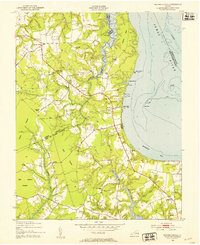
1948 · Bacons Castle
USGS Topo · 1:24,000

1949 · Richmond
USGS Topo · 1:250,000

1950 · Cobham Bay
USGS Topo · 1:24,000