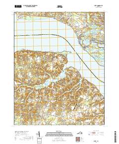
2019 Map of Surry
USGS Topo · Published 2019About this map
Colonial National Historical Park anchors the northeastern portion of this survey, protecting the historic landscape of Jamestown Island and its surrounding tidal marshes. The terrain is defined by the broad expanse of the James River, which separates the more densely developed neighborhoods of First Colony and Lakewood in James City County from the rural reaches of Surry County. On the southern shore, the settlement of Scotland serves as a transit point near Scotland Neck, while the county seat of Surry sits further inland, centered around the Surry County Courthouse.
Find a feature on this map
148 named features on this map. Tap any name to fly to it.
Don’t see what you’re looking for? This feature index may not catch every label — zoom into the map to look around manually.
Map Details
Editions of this 2019 Surry Map
This is the sole edition of this map. No revisions or reprints were ever made.
Other maps of this area

1906 · Williamsburg
USGS Topo · 1:62,500

1907 · Yorktown
USGS Topo · 1:62,500

1917 · Toano
USGS Topo · 1:62,500

1918 · Toano
USGS Topo · 1:62,500

1919 · Surry
USGS Topo · 1:62,500

1943 · Yorktown
USGS Topo · 1:62,500

1943 · Richmond
USGS Topo · 1:250,000
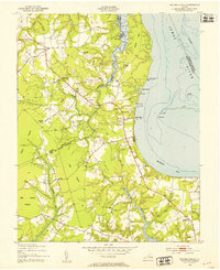
1948 · Bacons Castle
USGS Topo · 1:24,000

1949 · Richmond
USGS Topo · 1:250,000

1950 · Cobham Bay
USGS Topo · 1:24,000