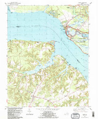
1983 Map of Surry
USGS Topo · Published 1983About this map
Colonial National Historical Park anchors the northern bank of the James River in this 1983 edition, highlighting the preserved historical landscape of the early Virginia colony. The map details the core commemorative area at Jamestown Festival State Park, including the Glass House Ruins and the Jamestown Visitor Center. Across the water, the south bank reveals a different character, marked by the agricultural and educational foundations of Surry County. Here, local history is preserved at Smith Fort and the Warren House, while the rural social fabric is evidenced by the presence of Oakwood Sch and Grace Union Ch. The topography is defined by the winding course of Grays Creek and Timber Neck, with the ferry route providing a critical connection between the historic sites of the north shore and the crossroads at Surry.
Find a feature on this map
87 named features on this map. Tap any name to fly to it.
Don’t see what you’re looking for? This feature index may not catch every label — zoom into the map to look around manually.
Map Details
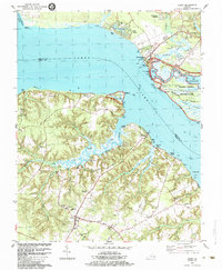
Editions of this 1983 Surry Map
2 editions found
Other maps of this area

1906 · Williamsburg
USGS Topo · 1:62,500

1907 · Yorktown
USGS Topo · 1:62,500

1917 · Toano
USGS Topo · 1:62,500

1918 · Toano
USGS Topo · 1:62,500

1919 · Surry
USGS Topo · 1:62,500

1943 · Yorktown
USGS Topo · 1:62,500

1943 · Richmond
USGS Topo · 1:250,000

1948 · Bacons Castle
USGS Topo · 1:24,000

1949 · Richmond
USGS Topo · 1:250,000

1950 · Cobham Bay
USGS Topo · 1:24,000