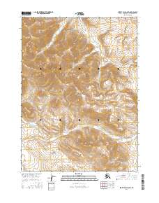
2016 Map of Survey Pass D-6 SW
USGS Topo · Published 2016About this map
Gates of the Arctic National Park encompasses the entire landscape of this 2016 survey, representing a strictly protected wilderness in the central Brooks Range. The terrain is defined by dramatic elevation changes, with the summit of Papik Mtn rising above the surrounding drainage basins. This interior Arctic environment is shaped by the complex hydrology of the Nigikpalugururvuk Cr and the smaller Midas Cr, which carve through the high-latitude valleys. The lack of roads or established settlements emphasizes the remote character of this region, which remained focused on preserving natural topographic features and indigenous hydrological names into the 21st century. The map provides a precise view of the Northwest Arctic's high-country contours as they were documented during modern federal land management efforts.
Find a feature on this map
11 named features on this map. Tap any name to fly to it.
Don’t see what you’re looking for? This feature index may not catch every label — zoom into the map to look around manually.
Map Details
Editions of this 2016 Survey Pass D-6 SW Map
This is the sole edition of this map. No revisions or reprints were ever made.
Other maps of this area

1951 · Survey Pass
USGS Topo · 1:250,000

1951 · Ambler River
USGS Topo · 1:250,000

1956 · Survey Pass
USGS Topo · 1:250,000

1956 · Ambler River
USGS Topo · 1:250,000

1964 · Survey Pass
USGS Topo · 1:250,000

1964 · Ambler River
USGS Topo · 1:250,000

1966 · Survey Pass
USGS Topo · 1:250,000
1984 · Survey Pass D-6
USGS Topo · 1:63,360
1990 · Ambler River C-1
USGS Topo · 1:63,360
1990 · Ambler River D-1
USGS Topo · 1:63,360