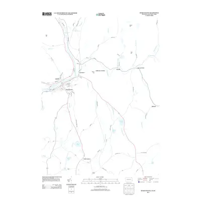
2013 Map of Susquehanna
USGS Topo · Published 2013About this map
Susquehanna River flows through the heart of this landscape, carving a prominent valley that serves as the anchor for the neighboring boroughs of Susquehanna and Oakland. The area's historical reliance on transportation is evident in the convergence of rail routes and old thoroughfares like the Lenox and Harmony Tpke. Significant local landmarks include the Devils Punch Bowl north of Lanesboro and the intersection at Jefferson Junction. Further east, the terrain is defined by the winding course of Starrucca Cr near Brandt, while the southern reaches move into quieter territory around North Jackson and Raskelly Corners. The map details a network of family-named roads and rural crossings, including Stevens Point and Melrose, reflecting the settled character of this border region where New York and Pennsylvania meet.
Find a feature on this map
85 named features on this map. Tap any name to fly to it.
Don’t see what you’re looking for? This feature index may not catch every label — zoom into the map to look around manually.
Map Details
Editions of this 2013 Susquehanna Map
This is the sole edition of this map. No revisions or reprints were ever made.
Other maps of this area

1905 · Nineveh
USGS Topo · 1:62,500

1924 · Starrucca
USGS Topo · 1:48,000

1924 · Deposit
USGS Topo · 1:62,500

1926 · Deposit
USGS Topo · 1:62,500

1926 · Starrucca
USGS Topo · 1:62,500

1930 · Starrucca
USGS Topo · 1:48,000

1932 · Susquehanna
USGS Topo · 1:62,500

1933 · Starrucca
USGS Topo · 1:62,500

1935 · Susquehanna
USGS Topo · 1:62,500

1943 · Honesdale
USGS Topo · 1:125,000