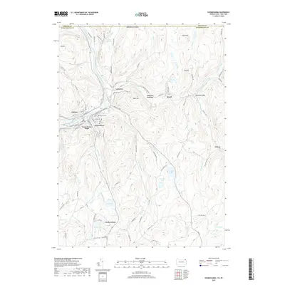
2019 Map of Susquehanna
USGS Topo · Published 2019About this map
The Susquehanna River winds through this terrain, defining the industrial and residential core of Susquehanna Depot and neighboring Lanesboro. The river valley acts as a corridor for transport and settlement, with the confluence of Starrucca Creek providing a natural focal point for Jefferson Junction. To the north, the geography is marked by the curious Devils Punch Bowl near Cascade Cr, while the southern reaches transition into a landscape dotted with numerous small water bodies including Comfort Lake and Ross Pond.
Find a feature on this map
99 named features on this map. Tap any name to fly to it.
Don’t see what you’re looking for? This feature index may not catch every label — zoom into the map to look around manually.
Map Details
Editions of this 2019 Susquehanna Map
This is the sole edition of this map. No revisions or reprints were ever made.
Other maps of this area

1905 · Nineveh
USGS Topo · 1:62,500

1924 · Starrucca
USGS Topo · 1:48,000

1924 · Deposit
USGS Topo · 1:62,500

1926 · Deposit
USGS Topo · 1:62,500

1926 · Starrucca
USGS Topo · 1:62,500

1930 · Starrucca
USGS Topo · 1:48,000

1932 · Susquehanna
USGS Topo · 1:62,500

1933 · Starrucca
USGS Topo · 1:62,500

1935 · Susquehanna
USGS Topo · 1:62,500

1943 · Honesdale
USGS Topo · 1:125,000