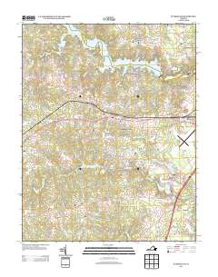
2013 Map of Sutherland
USGS Topo · Published 2013About this map
Lake Chesdin and the surrounding drainage of Hatcher Run define this portion of Dinwiddie County as it appeared in the early 21st century. The landscape is a mix of established rural residential communities and active recreational corridors, with Sutherland and Sutherland Manor serving as central points of reference. Transport and utility patterns are evident through the presence of the Dinwiddie County Airport and the commercial activity near Jack and Addison.
Find a feature on this map
100 named features on this map. Tap any name to fly to it.
Don’t see what you’re looking for? This feature index may not catch every label — zoom into the map to look around manually.
Map Details
Editions of this 2013 Sutherland Map
This is the sole edition of this map. No revisions or reprints were ever made.
Other maps of this area

1894 · Bermuda Hundred
USGS Topo · 1:62,500

1894 · Petersburg
USGS Topo · 1:62,500

1897 · Amelia
USGS Topo · 1:125,000

1943 · De Witt
USGS Topo · 1:24,000

1943 · Dinwiddie
USGS Topo · 1:24,000

1943 · Beach
USGS Topo · 1:24,000

1943 · Church Road
USGS Topo · 1:24,000

1943 · Winterpock
USGS Topo · 1:24,000

1943 · Sutherland
USGS Topo · 1:24,000

1943 · Richmond
USGS Topo · 1:250,000