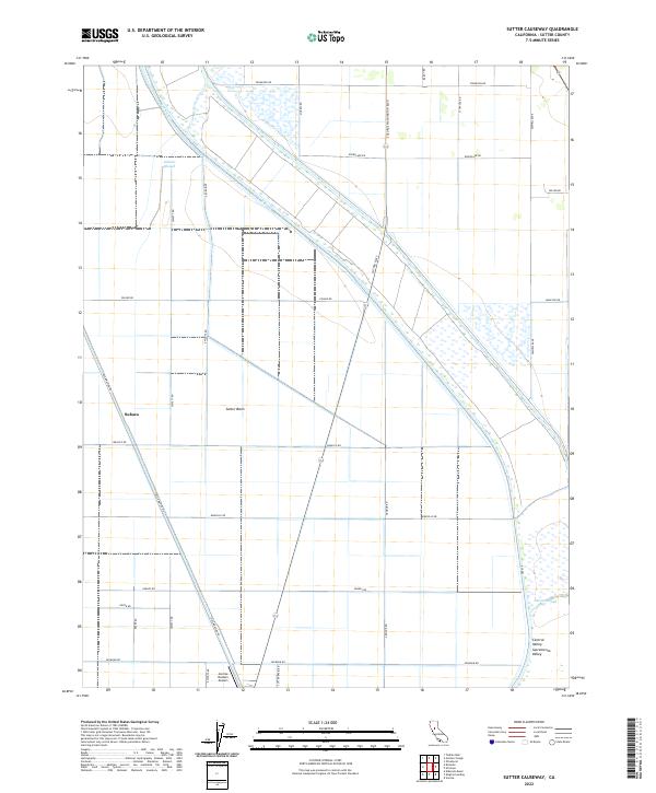
2022 Map of Sutter Causeway
USGS Topo · Published 2022About this map
The Sutter Basin floor of the Sacramento Valley is defined here by a highly organized grid of rural roads and water management infrastructure. Located in Sutter County, the landscape is dominated by agricultural drainage and irrigation features, including Gilsizer Slough and Nelson Slough along with the East Canal. The settlement of Subaco sits at a crossroads in the western portion of the map, while the Sunrise Dusters Airport at the southern edge highlights the area's continued reliance on aerial crop dusting services. The land is precisely partitioned by numerous local roads such as Reclamation Rd and Sutter Cswy, which reflect the extensive reclamation efforts that transformed this portion of the Central Valley into a productive agricultural engine.
Find a feature on this map
35 named features on this map. Tap any name to fly to it.
Don’t see what you’re looking for? This feature index may not catch every label — zoom into the map to look around manually.
Map Details
Editions of this 2022 Sutter Causeway Map
This is the sole edition of this map. No revisions or reprints were ever made.
Other maps of this area

1888 · Marysville
USGS Topo · 1:125,000

1891 · Marysville
USGS Topo · 1:125,000

1894 · Marysville
USGS Topo · 1:125,000

1895 · Marysville
USGS Topo · 1:125,000

1907 · Dunnigan
USGS Topo · 1:62,500

1910 · Knights Landing
USGS Topo · 1:31,680

1910 · Vernon
USGS Topo · 1:31,680

1910 · Nicolaus
USGS Topo · 1:31,680

1910 · Marcuse
USGS Topo · 1:31,680

1911 · Gilsizer Slough
USGS Topo · 1:31,680