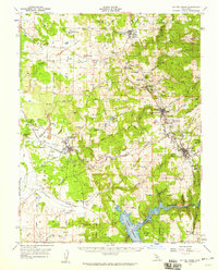
1957 Map of Sutter Creek
USGS Topo · Published 1959About this map
Gold Rush legacy defines the landscape in the heart of the Mother Lode, where the dense concentration of quartz mining operations follows the iconic vein through Amador City and Sutter Creek. This mid-century survey reveals a transition from deep-shaft mining to newer infrastructure, documenting legendary sites like the Kennedy Mine, Argonaut Mine, and Keystone Mine alongside the Sutter Hill County Airport. While larger towns thrive, former communities are marked as remnants, including Forest Home (Site) and Central House (Site). Further west, the Ione Valley supports brick and clay industries indicated by numerous Clay Pit markings and the sprawling campus of the Preston School of Industry. To the south, the recently constructed Pardee Reservoir on the Mokelumne River has permanently altered the river valley geography near Buena Vista.
Find a feature on this map
94 named features on this map. Tap any name to fly to it.
Don’t see what you’re looking for? This feature index may not catch every label — zoom into the map to look around manually.
Map Details
Editions of this 1957 Sutter Creek Map
This is the sole edition of this map. No revisions or reprints were ever made.
Other maps of this area

1889 · Jackson
USGS Topo · 1:125,000

1891 · Sacramento
USGS Topo · 1:125,000

1891 · Placerville
USGS Topo · 1:125,000

1892 · Jackson
USGS Topo · 1:125,000

1892 · Sacramento
USGS Topo · 1:125,000

1892 · Placerville
USGS Topo · 1:125,000

1893 · Placerville
USGS Topo · 1:125,000

1893 · Sacramento
USGS Topo · 1:125,000

1894 · Lodi
USGS Topo · 1:125,000

1897 · Jackson
USGS Topo · 1:125,000