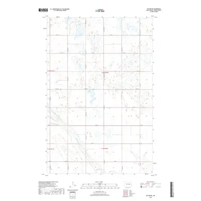
2018 Map of Sutton NE
USGS Topo · Published 2018About this map
Baldhill Creek meanders through the southern portion of this Griggs County landscape, defining the local drainage patterns across a region characterized by numerous depressions and prairie potholes. The map reveals a highly structured section-line road network, where routes like 102nd Ave NE and Main St intersect to form the geometric grid typical of North Dakota's agricultural heartland. Several significant water bodies dot the terrain, including Phelps Lake in the north and the centrally located Jones Lake. This 2018 survey illustrates the persistent rural character of the area, where the Public Land Survey System subdivisions of t146n r60w and t145n r60w dictate the placement of farmsteads and the sparse infrastructure of the northern plains.
Find a feature on this map
29 named features on this map. Tap any name to fly to it.
Don’t see what you’re looking for? This feature index may not catch every label — zoom into the map to look around manually.
Map Details
Editions of this 2018 Sutton NE Map
This is the sole edition of this map. No revisions or reprints were ever made.
Other maps of this area

1952 · New Rockford
USGS Topo · 1:250,000

1956 · New Rockford
USGS Topo · 1:250,000

1961 · Binford
USGS Topo · 1:24,000

1961 · Jessie
USGS Topo · 1:24,000

1961 · Sutton
USGS Topo · 1:24,000

1961 · Revere
USGS Topo · 1:24,000

1961 · Hannaford
USGS Topo · 1:24,000

1961 · Cooperstown West
USGS Topo · 1:24,000

1961 · Sutton NE
USGS Topo · 1:24,000
1961 · Mose
USGS Topo · 1:24,000