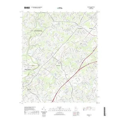
2020 Map of Suwanee
USGS Topo · Published 2020About this map
The Chattahoochee River defines the western edge of this suburban landscape, where the Chattahoochee River National Recreation Area preserves a corridor of green space amidst the rapid growth of Suwanee, Johns Creek, and Duluth. The map documents a modern network of transportation arteries like Peachtree Industrial Blvd and Nelson Brogdon Blvd, which weave through residential developments. Despite the contemporary urbanization, markers of the area's earlier rural character remain. Numerous small family burial grounds are interspersed throughout the residential blocks, including the Lockridge Family Cem, Connolly Cem, and Douglass Cem. Water features such as Fish Weir Shoals and the Littles Ferry Bridge crossing indicate the historical importance of the river for navigation and sustenance before the expansion of Sugar Hill and Buford.
Find a feature on this map
53 named features on this map. Tap any name to fly to it.
Don’t see what you’re looking for? This feature index may not catch every label — zoom into the map to look around manually.
Map Details
Editions of this 2020 Suwanee Map
This is the sole edition of this map. No revisions or reprints were ever made.
Other maps of this area

1888 · Atlanta
USGS Topo · 1:125,000

1890 · Suwanee
USGS Topo · 1:125,000

1890 · Atlanta
USGS Topo · 1:125,000

1891 · Gainesville
USGS Topo · 1:125,000

1892 · Atlanta
USGS Topo · 1:125,000

1894 · Suwanee
USGS Topo · 1:125,000

1895 · Atlanta
USGS Topo · 1:125,000

1896 · Monroe
USGS Topo · 1:125,000

1953 · Atlanta
USGS Topo · 1:250,000

1953 · Athens
USGS Topo · 1:250,000