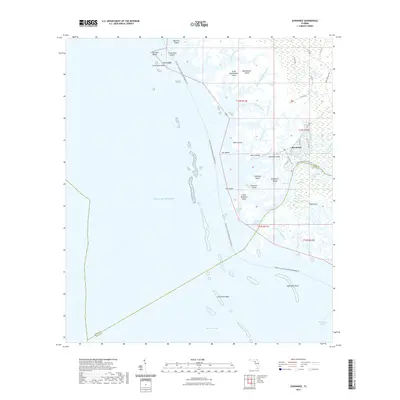
2021 Map of Suwannee
USGS Topo · Published 2021About this map
The Suwannee settlement sits at the mouth of the historic Suwannee River, where the freshwater flow meets the Gulf of Mexico through a complex network of passes and islands. This coastal landscape is dominated by the California Swamp and a series of named landforms such as Palm Island, Hog Island, and Bradford Island. The map illustrates the intricate water passages that define the region, including Alligator Pass, Wadley Pass, and West Pass.
Find a feature on this map
64 named features on this map. Tap any name to fly to it.
Don’t see what you’re looking for? This feature index may not catch every label — zoom into the map to look around manually.
Map Details
Editions of this 2021 Suwannee Map
This is the sole edition of this map. No revisions or reprints were ever made.
Other maps of this area

1954 · Horseshoe Beach
USGS Topo · 1:24,000

1954 · Suwannee
USGS Topo · 1:24,000

1954 · Vista
USGS Topo · 1:24,000

1954 · East Pass
USGS Topo · 1:24,000

1954 · Gainesville
USGS Topo · 1:250,000

1955 · Cedar Key
USGS Topo · 1:24,000

1955 · Shired Island
USGS Topo · 1:24,000

1958 · Gainesville
USGS Topo · 1:250,000

1959 · Gainesville
USGS Topo · 1:250,000

1978 · Cedar Keys
USGS Topo · 1:100,000