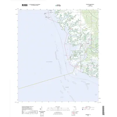
2024 Map of Suwannee
USGS Topo · Published 2024About this map
The Suwannee River meets the Gulf of Mexico in this coastal reach where the borders of Dixie and Levy counties converge. This environment is defined by the massive Lower Suwannee National Wildlife Refuge, protecting a complex network of salt marshes, tidal creeks, and islands. The settlement of Suwannee sits near the river mouth, serving as a hub for local waterways such as Salt Creek and Demory Creek.
Find a feature on this map
61 named features on this map. Tap any name to fly to it.
Don’t see what you’re looking for? This feature index may not catch every label — zoom into the map to look around manually.
Map Details
Editions of this 2024 Suwannee Map
This is the sole edition of this map. No revisions or reprints were ever made.
Other maps of this area

1954 · Horseshoe Beach
USGS Topo · 1:24,000

1954 · Suwannee
USGS Topo · 1:24,000

1954 · Vista
USGS Topo · 1:24,000

1954 · East Pass
USGS Topo · 1:24,000

1954 · Gainesville
USGS Topo · 1:250,000

1955 · Cedar Key
USGS Topo · 1:24,000

1955 · Shired Island
USGS Topo · 1:24,000

1958 · Gainesville
USGS Topo · 1:250,000

1959 · Gainesville
USGS Topo · 1:250,000

1978 · Cedar Keys
USGS Topo · 1:100,000