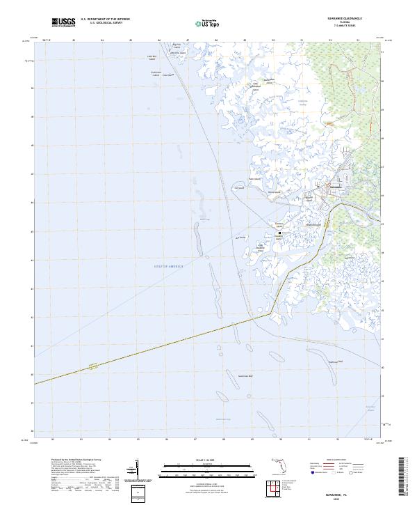
2025 Map of Suwannee
USGS Topo · Published 2025About this map
Suwannee marks the coastal terminus where the historic Suwannee River meets the Gulf of America along the Dixie and Levy county line. The landscape is defined by an intricate network of tidal creeks and marshes, including North Double Barrel Creek and Harden Creek, which weave between dozens of named islands like Bradford Island and Goodson Island. A high degree of protection for this estuary is evident through the Lower Suwannee National Wildlife Refuge, which encompasses much of the shore and interior wetlands like the California Swamp.
Find a feature on this map
59 named features on this map. Tap any name to fly to it.
Don’t see what you’re looking for? This feature index may not catch every label — zoom into the map to look around manually.
Map Details
Editions of this 2025 Suwannee Map
This is the sole edition of this map. No revisions or reprints were ever made.
Other maps of this area

1954 · Horseshoe Beach
USGS Topo · 1:24,000

1954 · Suwannee
USGS Topo · 1:24,000

1954 · Vista
USGS Topo · 1:24,000

1954 · East Pass
USGS Topo · 1:24,000

1954 · Gainesville
USGS Topo · 1:250,000

1955 · Cedar Key
USGS Topo · 1:24,000

1955 · Shired Island
USGS Topo · 1:24,000

1958 · Gainesville
USGS Topo · 1:250,000

1959 · Gainesville
USGS Topo · 1:250,000

1978 · Cedar Keys
USGS Topo · 1:100,000