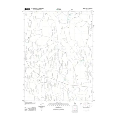
2012 Map of Swains Hole
USGS Topo · Published 2012About this map
Butte Creek meanders through a landscape defined by forest service routes and remote outposts in this northern California survey. The presence of Suicide Cabin, Cache Cabin, and Butte Creek Cabin suggests a history of timber management, ranching, or backcountry refuge within the high country. Small, isolated settlements like Mountain Home and Halls Flat are connected by a network of named tracks including Halls Flat Rd and Burnt Corral Rd. Water resources are central to this terrain, marked by several artificial and natural features such as Ballard Reservoir, Tamarack Reservoir, and the distinctive Swains Hole. To the south, Butte Creek Ranch occupies the lower ground near Bidwell Spring, while Signal Butte provides a significant local elevation point above the surrounding wooded tracts.
Find a feature on this map
127 named features on this map. Tap any name to fly to it.
Don’t see what you’re looking for? This feature index may not catch every label — zoom into the map to look around manually.
Map Details
Editions of this 2012 Swains Hole Map
This is the sole edition of this map. No revisions or reprints were ever made.
Other maps of this area

1886 · Lassen Peak
USGS Topo · 1:250,000

1892 · Lassen Peak
USGS Topo · 1:250,000

1894 · Lassen Peak
USGS Topo · 1:250,000

1939 · Halls Flat
USGS Topo · 1:125,000

1955 · Westwood
USGS Topo · 1:250,000

1956 · Harvey Mtn
USGS Topo · 1:62,500

1957 · Prospect Peak
USGS Topo · 1:62,500

1957 · Little Valley
USGS Topo · 1:62,500

1957 · Jellico
USGS Topo · 1:62,500

1958 · Westwood
USGS Topo · 1:250,000