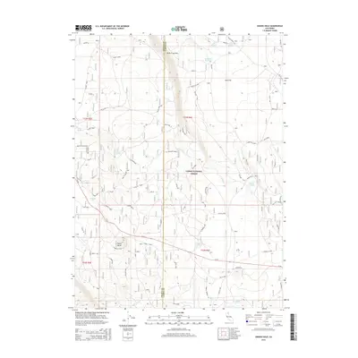
2015 Map of Swains Hole
USGS Topo · Published 2015About this map
Butte Creek Rim and the expansive Halls Flat define this high-altitude landscape within the Lassen National Forest during the mid-2010s. The geography is characterized by volcanic features and significant depressions, most notably the namesake Swains Hole and the distinct volcanic landmark of Signal Butte. Human presence is marked by isolated structures such as Cache Cabin and Half Cabin, alongside the W Butte Rch, reflecting a history of range management and timber harvesting in this part of Shasta and Lassen Counties.
Find a feature on this map
57 named features on this map. Tap any name to fly to it.
Don’t see what you’re looking for? This feature index may not catch every label — zoom into the map to look around manually.
Map Details
Editions of this 2015 Swains Hole Map
This is the sole edition of this map. No revisions or reprints were ever made.
Other maps of this area

1886 · Lassen Peak
USGS Topo · 1:250,000

1892 · Lassen Peak
USGS Topo · 1:250,000

1894 · Lassen Peak
USGS Topo · 1:250,000

1939 · Halls Flat
USGS Topo · 1:125,000

1955 · Westwood
USGS Topo · 1:250,000

1956 · Harvey Mtn
USGS Topo · 1:62,500

1957 · Prospect Peak
USGS Topo · 1:62,500

1957 · Little Valley
USGS Topo · 1:62,500

1957 · Jellico
USGS Topo · 1:62,500

1958 · Westwood
USGS Topo · 1:250,000