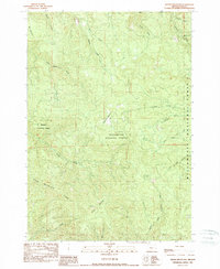
1989 Map of Swamp Mountain
USGS Topo · Published 1989About this map
Willamette National Forest encompasses much of this timber-rich landscape in the Cascades foothills during the late 1980s. The terrain is defined by prominent elevations like Swamp Mountain and Doe Mountain, with the long crest of Green Mountain Ridge cutting across the southern half of the sheet. Resource management and historical land use are evident through features such as a Lookout Tower (Used) and a localized Quarry.
Find a feature on this map
25 named features on this map. Tap any name to fly to it.
Don’t see what you’re looking for? This feature index may not catch every label — zoom into the map to look around manually.
Map Details
Editions of this 1989 Swamp Mountain Map
This is the sole edition of this map. No revisions or reprints were ever made.
Other maps of this area

1934 · Mc Kenzie Bridge
USGS Topo · 1:96,000

1940 · Mc Kenzie Bridge
USGS Topo · 1:125,000

1951 · Sweet Home
USGS Topo · 1:62,500

1951 · Leaburg
USGS Topo · 1:62,500

1953 · Salem
USGS Topo · 1:250,000

1954 · Salem
USGS Topo · 1:250,000

1955 · Blue River
USGS Topo · 1:62,500

1955 · Cascadia
USGS Topo · 1:62,500

1960 · Salem
USGS Topo · 1:250,000

1962 · Salem
USGS Topo · 1:250,000