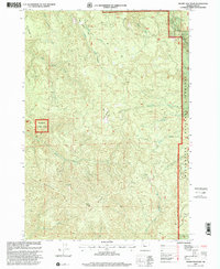
1997 Map of Swamp Mountain
USGS Topo · Published 2001About this map
Willamette National Forest encompasses the majority of this drainage system, defined by high peaks and an intricate network of waterways. The topography is anchored by Swamp Mountain and the prominent Green Mountain Ridge to the south, which divides the various creek basins. Water flows through numerous named channels including Wiley Creek, Wolf Creek, and House Creek, illustrating the complex hydrological layout of this timber-rich region.
Find a feature on this map
22 named features on this map. Tap any name to fly to it.
Don’t see what you’re looking for? This feature index may not catch every label — zoom into the map to look around manually.
Map Details
Editions of this 1997 Swamp Mountain Map
This is the sole edition of this map. No revisions or reprints were ever made.
Other maps of this area

1934 · Mc Kenzie Bridge
USGS Topo · 1:96,000

1940 · Mc Kenzie Bridge
USGS Topo · 1:125,000

1951 · Sweet Home
USGS Topo · 1:62,500

1951 · Leaburg
USGS Topo · 1:62,500

1953 · Salem
USGS Topo · 1:250,000

1954 · Salem
USGS Topo · 1:250,000

1955 · Blue River
USGS Topo · 1:62,500

1955 · Cascadia
USGS Topo · 1:62,500

1960 · Salem
USGS Topo · 1:250,000

1962 · Salem
USGS Topo · 1:250,000