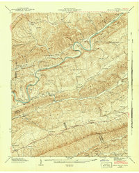
1942 Map of Swan Island
USGS Topo · Published 1942About this map
The Clinch River carves a winding path through the parallel ridges of East Tennessee, defining the life and movement of this rural landscape in the early 1940s. Transportation relies on the river and its crossings, most notably Manning Ferry and the numerous bends like Crane-neck Bend and Lawson Bend. This era shows a dense network of local institutions that anchored family life, including Providence Sch, Clinchview Sch, and Friendly Chapel.
Find a feature on this map
118 named features on this map. Tap any name to fly to it.
Don’t see what you’re looking for? This feature index may not catch every label — zoom into the map to look around manually.
Map Details
Editions of this 1942 Swan Island Map
This is the sole edition of this map. No revisions or reprints were ever made.
Other maps of this area

1883 · Morristown
USGS Topo · 1:125,000

1887 · Jonesville
USGS Topo · 1:125,000

1891 · Jonesville
USGS Topo · 1:125,000

1893 · Morristown
USGS Topo · 1:125,000

1895 · Morristown
USGS Topo · 1:125,000

1932 · Hagan
USGS Topo · 1:62,500

1935 · Rogersville
USGS Topo · 1:48,000

1935 · Tate Springs
USGS Topo · 1:48,000

1935 · Lee Valley
USGS Topo · 1:24,000
1935 · Colman
USGS Topo · 1:24,000