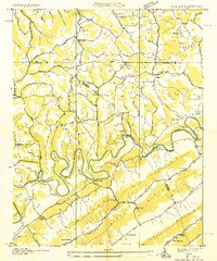
1935 Map of Colman
USGS Topo · Published 1935About this map
The Powell River dominates this 1935 landscape, carving deep loops through the terrain at Rowland Bend and Eastridge Bend. Surveyed during the Tennessee Valley Authority era, the map reveals a rural economy dependent on river crossings and small-scale industry, evidenced by Brooks Ferry and the Yeary Mill. The social fabric of these ridge-and-valley communities is remarkably detailed, showing a high density of local institutions such as Dunkard Ch, Smith Chapel, and a wide network of one-room schoolhouses like Big Spring Union Sch and Gibson Hall Sch. Significant topographical features like Wallen Ridge and Powell Mountain hem in the settlements, while early river crossings at Parkey Bridge and Buchanon Ford illustrate the essential transit points for residents of Claiborne and Hancock counties.
Find a feature on this map
77 named features on this map. Tap any name to fly to it.
Don’t see what you’re looking for? This feature index may not catch every label — zoom into the map to look around manually.
Map Details
Editions of this 1935 Colman Map
2 editions found
Other maps of this area

1883 · Morristown
USGS Topo · 1:125,000

1886 · Cumberland Gap
USGS Topo · 1:125,000

1887 · Jonesville
USGS Topo · 1:125,000

1888 · Cumberland Gap
USGS Topo · 1:125,000

1891 · Cumberland Gap
USGS Topo · 1:125,000

1891 · Jonesville
USGS Topo · 1:125,000

1893 · Morristown
USGS Topo · 1:125,000

1895 · Morristown
USGS Topo · 1:125,000

1897 · Maynardville
USGS Topo · 1:125,000

1900 · Maynardville
USGS Topo · 1:125,000